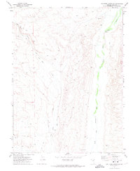
1971 Map of Coal Mine Canyon SE
USGS Topo · Published 1974About this map
The North Fork Humboldt River carves a distinct green corridor through this Elko County landscape, serving as a primary water source in an otherwise arid region. In the early 1970s, the area remained largely defined by livestock management and mineral access, as evidenced by the network of Jeep Trails and the prominent Coal Mine Road that winds through Coal Mine Canyon. These routes connected remote rangeland to established water points, such as Twelvemile Well and Devils Gate Well. The presence of the Elko N Base landmark suggests the importance of this terrain for regional surveying and geodetic control. Topographic detail illustrates the complex drainage systems feeding into Coal Mine Creek, which eventually meets the river to the east, showing the typical Western rangeland infrastructure where isolated wells like North Fork Well supported the cattle industry of the era.
Find a feature on this map
12 named features on this map. Tap any name to fly to it.
Don’t see what you’re looking for? This feature index may not catch every label — zoom into the map to look around manually.
Map Details
Editions of this 1971 Coal Mine Canyon SE Map
This is the sole edition of this map. No revisions or reprints were ever made.
Other maps of this area

1935 · Halleck
USGS Topo · 1:125,000

1955 · Wells
USGS Topo · 1:250,000

1955 · Elko
USGS Topo · 1:250,000

1958 · Wells
USGS Topo · 1:250,000

1958 · Elko
USGS Topo · 1:250,000

1961 · Wells
USGS Topo · 1:250,000

1962 · Elko
USGS Topo · 1:250,000

1962 · Ryndon
USGS Topo · 1:24,000

1962 · Osino
USGS Topo · 1:24,000

1965 · Elko
USGS Topo · 1:250,000