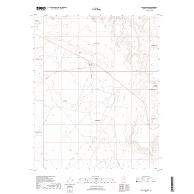
2018 Map of Coal Mine Mesa
USGS Topo · Published 2018About this map
Coal Mine Mesa dominates this Coconino County landscape, rising between the Moenkopi Plateau to the southwest and the eastern edges of Howell Mesa. This 2018 survey illustrates a high-desert environment where transportation is defined by a sparse network of Bureau of Indian Affairs routes, including Indian Rte 6032 and Indian Rte 6033, which navigate the tablelands. The topography is sharply defined by the dramatic descent into Ha Ho No Geh Canyon in the northeast and the prominent landmark of Blue Point. The arrangement of these roads suggests a landscape managed for movement across the mesas rather than dense settlement, preserving the character of the traditional tribal lands within the modern public land survey system.
Find a feature on this map
14 named features on this map. Tap any name to fly to it.
Don’t see what you’re looking for? This feature index may not catch every label — zoom into the map to look around manually.
Map Details
Editions of this 2018 Coal Mine Mesa Map
This is the sole edition of this map. No revisions or reprints were ever made.
Other maps of this area

1883 · Marsh Pass
USGS Topo · 1:250,000

1883 · Tusayan
USGS Topo · 1:250,000

1886 · Tusayan
USGS Topo · 1:250,000

1886 · San Francisco Mtns
USGS Topo · 1:250,000

1886 · Echo Cliffs
USGS Topo · 1:250,000

1891 · San Francisco Mtns
USGS Topo · 1:250,000

1891 · Echo Cliffs
USGS Topo · 1:250,000

1892 · Marsh Pass
USGS Topo · 1:250,000

1894 · San Francisco Mtns
USGS Topo · 1:250,000

1899 · San Francisco Mtns
USGS Topo · 1:250,000