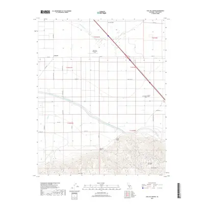
2018 Map of Coal Oil Canyon
USGS Topo · Published 2018About this map
The Kern Lake Bed and the foothills of the San Emigdio Mountains define this southern reach of the San Joaquin Valley in 2018. The settlement of Lakeview sits near the intersection of Old River Rd and Copus Rd, anchoring a landscape transitioned from historic lakebed into a grid of agricultural and transport infrastructure. Modern engineering is prominent, specifically the Governor-Edmund-G-Brown California Aqueduct which cuts across the central flats to manage the region's water. To the south, the terrain rises sharply into the Pleito Hills, where deep drainages like Coal Oil Canyon and Telegraph Canyon descend from the mountains. Specialized land use is evident at the Skydive San Joaquin Valley Airport, while the tiny enclave of Wheeler Ridge stands at the southeastern edge, where the valley floor meets the rising mountain slopes.
Find a feature on this map
33 named features on this map. Tap any name to fly to it.
Don’t see what you’re looking for? This feature index may not catch every label — zoom into the map to look around manually.
Map Details
Editions of this 2018 Coal Oil Canyon Map
This is the sole edition of this map. No revisions or reprints were ever made.
Other maps of this area

1903 · Mt. Pinos
USGS Topo · 1:125,000

1903 · Tejon
USGS Topo · 1:125,000

1910 · Buena Vista Lake
USGS Topo · 1:125,000

1912 · Buena Vista Lake
USGS Topo · 1:125,000

1914 · Caliente
USGS Topo · 1:125,000

1930 · Weed Patch
USGS Topo · 1:31,680

1930 · Millux
USGS Topo · 1:31,680

1930 · Conner
USGS Topo · 1:31,680

1931 · West of Tejon Hills
USGS Topo · 1:31,680

1931 · Hayes Ranch
USGS Topo · 1:31,680