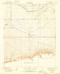
1950 Map of Coal Oil Canyon
USGS Topo · Published 1950About this map
Wheeler Ridge dominates the southern landscape of this mid-century survey, rising sharply above the oil-rich flats of the southern San Joaquin Valley. The map documents an industrial corridor defined by the General Petroleum Corp Emigdio Pumping Sta and the Richfield Oil Co Pumping Station, signaling the region's mid-century petroleum development. Irrigation infrastructure is equally prominent, with the Kern Island Ditch cutting across the northern sections, facilitating the transition from arid scrub to productive agricultural land.
Find a feature on this map
13 named features on this map. Tap any name to fly to it.
Don’t see what you’re looking for? This feature index may not catch every label — zoom into the map to look around manually.
Map Details
Editions of this 1950 Coal Oil Canyon Map
This is the sole edition of this map. No revisions or reprints were ever made.
Other maps of this area

1903 · Mt. Pinos
USGS Topo · 1:125,000

1903 · Tejon
USGS Topo · 1:125,000

1910 · Buena Vista Lake
USGS Topo · 1:125,000

1912 · Buena Vista Lake
USGS Topo · 1:125,000

1914 · Caliente
USGS Topo · 1:125,000

1930 · Weed Patch
USGS Topo · 1:31,680

1930 · Millux
USGS Topo · 1:31,680

1930 · Conner
USGS Topo · 1:31,680

1931 · West of Tejon Hills
USGS Topo · 1:31,680

1931 · Hayes Ranch
USGS Topo · 1:31,680