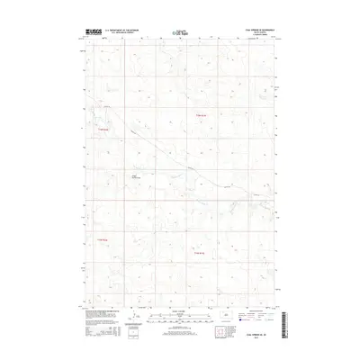
2015 Map of Coal Springs SE
USGS Topo · Published 2015About this map
Thunder Butte Cr meanders across this Ziebach County landscape, carving a detailed drainage network into the South Dakota prairie. The terrain is defined by dramatic elevation changes and dry washes like School Section Draw, which highlight the natural erosion patterns of the northern plains. This 2015 survey reflects a modern digital mapping era where traditional range and township lines, such as t16n r17e, still anchor the land ownership and agricultural divisions established over a century ago. Transport through this open country relies on local routes like Foster Rd, which cuts diagonally across the topography to connect disparate ranching properties. The prominence of Butte Cr and its tributaries underscores the importance of seasonal water systems in an area where the topography is otherwise shaped by the wind and the wide-open spaces of the western Dakotas.
Find a feature on this map
8 named features on this map. Tap any name to fly to it.
Don’t see what you’re looking for? This feature index may not catch every label — zoom into the map to look around manually.
Map Details
Editions of this 2015 Coal Springs SE Map
This is the sole edition of this map. No revisions or reprints were ever made.
Other maps of this area

1951 · Redelm NW
USGS Topo · 1:24,000

1951 · Faith NE
USGS Topo · 1:24,000

1952 · Faith NW
USGS Topo · 1:24,000

1953 · McIntosh
USGS Topo · 1:250,000

1954 · Lemmon
USGS Topo · 1:250,000

1957 · Lemmon
USGS Topo · 1:250,000

1958 · McIntosh
USGS Topo · 1:250,000

1982 · Glad Valley SW
USGS Topo · 1:24,000

1982 · Glad Valley NW
USGS Topo · 1:24,000

1983 · Coal Springs
USGS Topo · 1:24,000