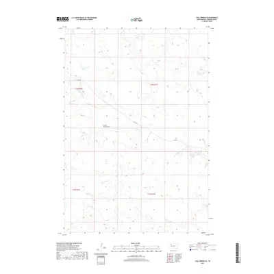
2017 Map of Coal Springs SE
USGS Topo · Published 2017About this map
Thunder Butte Creek and Berry Creek define the drainage of this portion of Perkins County, where the landscape is marked by the distinct topographical depressions of School Section Draw. This area of South Dakota, mapped in 2017, is characterized by its large-scale section divisions across Townships 15 and 16 North, spanning Ranges 16 and 17 East. The sparse road network is centered on Foster Rd, which cuts diagonally across the terrain, reflecting the expansive agricultural and ranching parcels common to this region. The map provides a precise look at the land survey system and natural watercourses that have historically shaped land use in this part of the state.
Find a feature on this map
8 named features on this map. Tap any name to fly to it.
Don’t see what you’re looking for? This feature index may not catch every label — zoom into the map to look around manually.
Map Details
Editions of this 2017 Coal Springs SE Map
This is the sole edition of this map. No revisions or reprints were ever made.
Other maps of this area

1951 · Redelm NW
USGS Topo · 1:24,000

1951 · Faith NE
USGS Topo · 1:24,000

1952 · Faith NW
USGS Topo · 1:24,000

1953 · McIntosh
USGS Topo · 1:250,000

1954 · Lemmon
USGS Topo · 1:250,000

1957 · Lemmon
USGS Topo · 1:250,000

1958 · McIntosh
USGS Topo · 1:250,000

1982 · Glad Valley SW
USGS Topo · 1:24,000

1982 · Glad Valley NW
USGS Topo · 1:24,000

1983 · Coal Springs
USGS Topo · 1:24,000