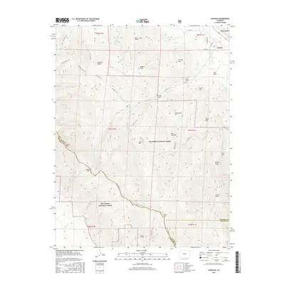
2016 Map of Coaldale
USGS Topo · Published 2016About this map
Coaldale and Pleasanton serve as the primary human outposts at the edge of the high Sangre de Cristo range in this modern survey. The map details a landscape where administrative boundaries and recreational access meet, with the San Isabel National Forest and Rio Grande National Forest converging along the mountain crest. This boundary is marked by high-altitude features like Hayden Pass and Galena Peak. The terrain is deeply incised by drainages such as Italian Gulch, Pole Gulch, and Trash Gulch, illustrating the complex drainage patterns feeding the Arkansas River valley. An extensive network of backcountry routes, including the Rainbow Trail and Black Canyon Trail, connects these drainages to high-alpine destinations like the Bushnell Lakes and Stout Creek Lakes.
Find a feature on this map
55 named features on this map. Tap any name to fly to it.
Don’t see what you’re looking for? This feature index may not catch every label — zoom into the map to look around manually.
Map Details
Editions of this 2016 Coaldale Map
This is the sole edition of this map. No revisions or reprints were ever made.
Other maps of this area

1950 · Valley View Hot Springs
USGS Topo · 1:24,000

1954 · Pueblo
USGS Topo · 1:250,000

1957 · Pueblo
USGS Topo · 1:250,000

1958 · Pueblo
USGS Topo · 1:250,000

1959 · Electric Peak
USGS Topo · 1:62,500

1959 · Howard
USGS Topo · 1:62,500

1959 · Cotopaxi
USGS Topo · 1:62,500

1962 · Pueblo
USGS Topo · 1:250,000

1966 · Pueblo
USGS Topo · 1:250,000
1967 · Valley View Hot Springs
USGS Topo · 1:24,000