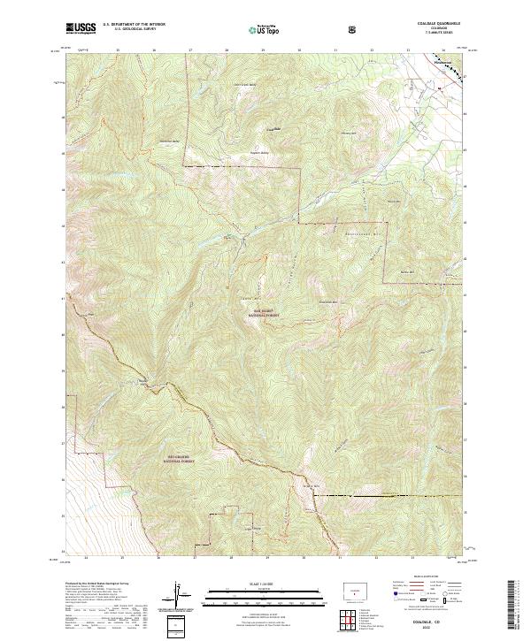
2022 Map of Coaldale
USGS Topo · Published 2022About this map
Coaldale and Pleasanton anchor this 2022 survey of the high-country border between Fremont, Saguache, and Custer counties. The landscape is dominated by the dramatic elevation changes within the San Isabel National Forest and Rio Grande National Forest, where steep drainages like Italian Gulch and Trash Gulch cut through the granite massif. A single Quarry near Steel Canyon indicates localized industrial activity amidst the wilderness. This map provides critical detail for tracing the Rainbow Trl, which skirts the eastern slopes of prominent peaks such as Hayden Baldy and Hamilton Baldy. The transition from the high-altitude Hayden Pass down to the valley floors illustrates the classic corridor-and-peak geography of the Sangre de Cristo range, preserved here with contemporary accuracy for researchers and hikers alike.
Find a feature on this map
62 named features on this map. Tap any name to fly to it.
Don’t see what you’re looking for? This feature index may not catch every label — zoom into the map to look around manually.
Map Details
Editions of this 2022 Coaldale Map
This is the sole edition of this map. No revisions or reprints were ever made.
Other maps of this area

1950 · Valley View Hot Springs
USGS Topo · 1:24,000

1954 · Pueblo
USGS Topo · 1:250,000

1957 · Pueblo
USGS Topo · 1:250,000

1958 · Pueblo
USGS Topo · 1:250,000

1959 · Electric Peak
USGS Topo · 1:62,500

1959 · Howard
USGS Topo · 1:62,500

1959 · Cotopaxi
USGS Topo · 1:62,500

1962 · Pueblo
USGS Topo · 1:250,000

1966 · Pueblo
USGS Topo · 1:250,000
1967 · Valley View Hot Springs
USGS Topo · 1:24,000