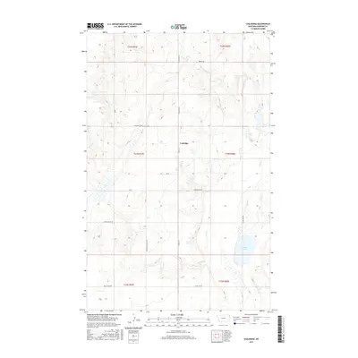
2017 Map of Coalridge
USGS Topo · Published 2017About this map
Coalridge occupies a central position within this Sheridan County landscape, where the high plains of northeastern Montana are defined by a grid of rural section lines and local thoroughfares. The terrain is shaped by the drainage of Lake Cr, which flows through the eastern portion of the quadrangle toward Clear Lake. This 2017 survey reveals a persistent pattern of land use where transportation routes often follow old township and range boundaries, including Coalridge Hwy and Hwy 516. Local heritage is reflected in specific road names such as Brotherhood Hall Rd, Emmaus Rd, and Longfellow Rd, suggesting the historical locations of community gathering points and family homesteads. The map provides a clear view of the sparse, organized settlement typical of the region, anchored by the namesake locality of Coalridge.
Find a feature on this map
19 named features on this map. Tap any name to fly to it.
Don’t see what you’re looking for? This feature index may not catch every label — zoom into the map to look around manually.
Map Details
Editions of this 2017 Coalridge Map
This is the sole edition of this map. No revisions or reprints were ever made.
Other maps of this area

1946 · Brush Lake
USGS Topo · 1:24,000

1946 · Dagmar
USGS Topo · 1:24,000

1948 · Dagmar
USGS Topo · 1:24,000

1948 · Brush Lake
USGS Topo · 1:24,000

1948 · Reserve SE
USGS Topo · 1:24,000

1949 · Reserve SE
USGS Topo · 1:24,000

1954 · Wolf Point
USGS Topo · 1:250,000

1958 · Wolf Point
USGS Topo · 1:250,000

1983 · Tadpole Lake
USGS Topo · 1:24,000

1983 · Dooley SE
USGS Topo · 1:24,000