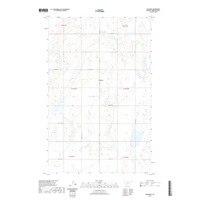
2020 Map of Coalridge
USGS Topo · Published 2020About this map
Coalridge serves as the central point of this northeastern Montana landscape, situated at the intersection of Hwy 516 and the Coalridge Hwy. This region of Sheridan County is characterized by a sparse, systematic grid of rural thoroughfares that provide access to the undulating terrain and numerous intermittent wetlands. The naming of roads such as Brotherhood Hall Rd, Emmaus Rd, and Longfellow Rd suggests a community shaped by specific social and cultural touchstones. To the southeast, Clear Lake stands out as a prominent water feature, fed by the winding course of Lake Cr. The map captures a contemporary look at the section-line roads and drainage patterns, including Lowell Valley Rd and Valley View Rd, which define the agricultural and residential layout of this remote high-plains environment.
Find a feature on this map
17 named features on this map. Tap any name to fly to it.
Don’t see what you’re looking for? This feature index may not catch every label — zoom into the map to look around manually.
Map Details
Editions of this 2020 Coalridge Map
This is the sole edition of this map. No revisions or reprints were ever made.
Other maps of this area

1946 · Brush Lake
USGS Topo · 1:24,000

1946 · Dagmar
USGS Topo · 1:24,000

1948 · Dagmar
USGS Topo · 1:24,000

1948 · Brush Lake
USGS Topo · 1:24,000

1948 · Reserve SE
USGS Topo · 1:24,000

1949 · Reserve SE
USGS Topo · 1:24,000

1954 · Wolf Point
USGS Topo · 1:250,000

1958 · Wolf Point
USGS Topo · 1:250,000

1983 · Tadpole Lake
USGS Topo · 1:24,000

1983 · Dooley SE
USGS Topo · 1:24,000