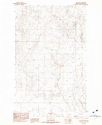
1983 Map of Coalridge
USGS Topo · Published 1983About this map
Coalridge occupies a landscape defined by the intersection of industrial extraction and glacial water features in Sheridan County. Based on field checks from the late 1970s, this map documents a local economy tied to the land, notably marked by a Strip Mine and clustered Storage Bins that suggest active agricultural or mineral staging. The terrain is pocketed with numerous unnamed depressions and water bodies, with Clear Lake and Lake Creek serving as the primary drainage features. A small Cem near the town site provides a point of interest for genealogists tracing families in this corner of Montana, where the transition between Townships 35, 34, and 33 North marks the legal geography of the high plains.
Find a feature on this map
8 named features on this map. Tap any name to fly to it.
Don’t see what you’re looking for? This feature index may not catch every label — zoom into the map to look around manually.
Map Details
Editions of this 1983 Coalridge Map
This is the sole edition of this map. No revisions or reprints were ever made.
Other maps of this area

1946 · Brush Lake
USGS Topo · 1:24,000

1946 · Dagmar
USGS Topo · 1:24,000

1948 · Dagmar
USGS Topo · 1:24,000

1948 · Brush Lake
USGS Topo · 1:24,000

1948 · Reserve SE
USGS Topo · 1:24,000

1949 · Reserve SE
USGS Topo · 1:24,000

1954 · Wolf Point
USGS Topo · 1:250,000

1958 · Wolf Point
USGS Topo · 1:250,000

1983 · Tadpole Lake
USGS Topo · 1:24,000

1983 · Dooley SE
USGS Topo · 1:24,000