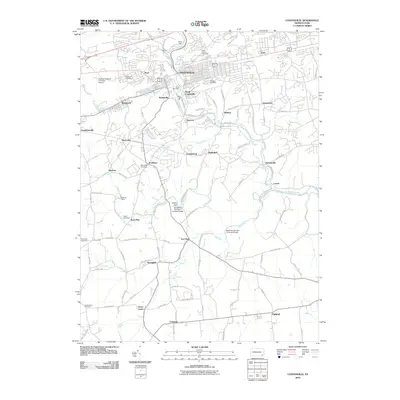
2010 Map of Coatesville
USGS Topo · Published 2010About this map
Coatesville and its surrounding communities are documented here in a detailed landscape shaped by the West Branch Brandywine Creek and its many tributaries. The area reflects a complex settlement pattern of small villages and residential clusters, including South Coatesville, Modena, and Ercildoun. Water management is evident through features like the Rock Run Dam and Kurtz Dam, which historically supported local industry and municipal needs.
Find a feature on this map
96 named features on this map. Tap any name to fly to it.
Don’t see what you’re looking for? This feature index may not catch every label — zoom into the map to look around manually.
Map Details
Editions of this 2010 Coatesville Map
This is the sole edition of this map. No revisions or reprints were ever made.
Other maps of this area

1901 · West Chester
USGS Topo · 1:62,500

1904 · West Chester
USGS Topo · 1:62,500

1904 · Coatesville
USGS Topo · 1:62,500

1905 · Honey Brook
USGS Topo · 1:62,500

1906 · Phoenixville
USGS Topo · 1:62,500

1906 · Coatesville
USGS Topo · 1:62,500

1907 · Honeybrook
USGS Topo · 1:62,500

1918 · Coatesville
USGS Topo · 1:62,500

1941 · Honeybrook
USGS Topo · 1:62,500

1943 · Coatesville
USGS Topo · 1:62,500