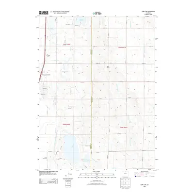
2013 Map of Cobb Lake
USGS Topo · Published 2013About this map
The town of Wellington anchors the western edge of this High Plains landscape, where early 21st-century residential developments like those along Inspiration Dr and Woodlake Ln meet a sophisticated network of agricultural water management. The area is defined by its reliance on irrigation, visible through the complex path of the Windsor Ditch, Larimer County Canal, and the Cactus Hill Lateral. These waterways feed numerous storage points including Cobb Lake, Lillie Reservoir, and Mountain Supply Reservoir Number 18.
Find a feature on this map
56 named features on this map. Tap any name to fly to it.
Don’t see what you’re looking for? This feature index may not catch every label — zoom into the map to look around manually.
Map Details
Editions of this 2013 Cobb Lake Map
This is the sole edition of this map. No revisions or reprints were ever made.
Other maps of this area

1906 · Fort Collins
USGS Topo · 1:62,500

1907 · Livermore
USGS Topo · 1:125,000

1908 · Fort Collins
USGS Topo · 1:62,500

1908 · Eaton
USGS Topo · 1:125,000

1909 · Livermore
USGS Topo · 1:125,000

1910 · Eaton
USGS Topo · 1:125,000

1954 · Greeley
USGS Topo · 1:250,000

1957 · Greeley
USGS Topo · 1:250,000

1958 · Greeley
USGS Topo · 1:250,000
1960 · Fort Collins
USGS Topo · 1:24,000