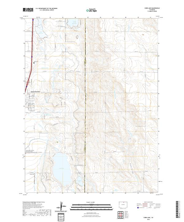
2022 Map of Cobb Lake
USGS Topo · Published 2022About this map
Wellington anchors the western edge of this 2022 survey, showcasing a landscape defined by an intricate network of water management. The terrain is marked by essential agricultural infrastructure, including the Windsor Ditch, Cowan Lateral, and Cactus Hill Lateral, which feed numerous storage bodies like Cobb Lake and Hinkley Lake. This irrigation system supports the extensive operations of the Colorado State University Agricultural Research Development and Education Center, a major feature in the southwestern portion of the quadrangle. North of the primary settlement, Highland Cem provides a point of genealogical interest, while the eastern reaches are characterized by the winding paths of Black Hollow and Coalbank Cr. The transition from the residential streets of Wellington to the structured research fields and reservoirs illustrates the ongoing agricultural importance of this region near the Larimer and Weld county line.
Find a feature on this map
70 named features on this map. Tap any name to fly to it.
Don’t see what you’re looking for? This feature index may not catch every label — zoom into the map to look around manually.
Map Details
Editions of this 2022 Cobb Lake Map
This is the sole edition of this map. No revisions or reprints were ever made.
Other maps of this area

1906 · Fort Collins
USGS Topo · 1:62,500

1907 · Livermore
USGS Topo · 1:125,000

1908 · Fort Collins
USGS Topo · 1:62,500

1908 · Eaton
USGS Topo · 1:125,000

1909 · Livermore
USGS Topo · 1:125,000

1910 · Eaton
USGS Topo · 1:125,000

1954 · Greeley
USGS Topo · 1:250,000

1957 · Greeley
USGS Topo · 1:250,000

1958 · Greeley
USGS Topo · 1:250,000
1960 · Fort Collins
USGS Topo · 1:24,000