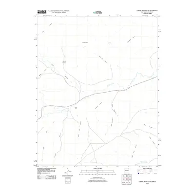
2010 Map of Cobert Mesa South
USGS Topo · Published 2010About this map
Cobert Mesa dominates the high plateau landscape of this 2010 survey, providing a clear view of the complex drainage systems that define the borderlands of Las Animas County. The Dry Cimarron River winds through the central portion of the map, carving a wide valley floor between high mesas. This river system acts as the primary topographical anchor, with numerous tributary canyons such as Indian Trail Canyon and Boulder Canyon feeding into the main channel. Evidence of transportation and local access is seen in the path of County Hwy B-038, which follows the contours of Long Canyon to bridge the upland areas with the valley below. To the south, the Folsom Area and the headwaters of Travesser Creek mark a transition in the terrain, where deeper incisions like Sand Well Canyon and Turkey Canyon begin to dominate the landscape.
Find a feature on this map
20 named features on this map. Tap any name to fly to it.
Don’t see what you’re looking for? This feature index may not catch every label — zoom into the map to look around manually.
Map Details
Editions of this 2010 Cobert Mesa South Map
This is the sole edition of this map. No revisions or reprints were ever made.
Other maps of this area

1891 · Mesa De Maya
USGS Topo · 1:125,000

1892 · Mt Carrizo
USGS Topo · 1:125,000

1893 · Mesa de Maya
USGS Topo · 1:125,000

1954 · Dalhart
USGS Topo · 1:250,000

1955 · La Junta
USGS Topo · 1:250,000

1958 · La Junta
USGS Topo · 1:250,000

1958 · Dalhart
USGS Topo · 1:250,000

1962 · Dalhart
USGS Topo · 1:250,000

1968 · La Junta
USGS Topo · 1:250,000

1972 · Travesser Park
USGS Topo · 1:24,000