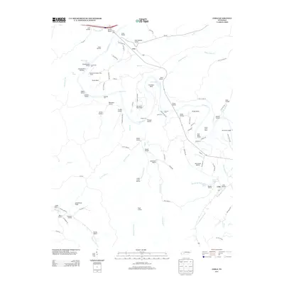
2013 Map of Coble
USGS Topo · Published 2013About this map
The Duck River meanders through this portion of Hickman County, carving a series of dramatic loops and bends including Brown Bend, Horseshoe Bend, and Wright Bend. This winding watercourse was historically navigable at specific points, evidenced by the numerous named crossings such as Grandmother Ford, Burchard Ford, and Perogue Ford. The small community of Only sits near the northern boundary, while the namesake settlement of Coble occupies the southeastern corner.
Find a feature on this map
104 named features on this map. Tap any name to fly to it.
Don’t see what you’re looking for? This feature index may not catch every label — zoom into the map to look around manually.
Map Details
Editions of this 2013 Coble Map
This is the sole edition of this map. No revisions or reprints were ever made.
Other maps of this area

1936 · Pleasantville
USGS Topo · 1:24,000

1936 · Hurricane Mills
USGS Topo · 1:24,000

1936 · Coble
USGS Topo · 1:24,000

1936 · Beaverdam Springs
USGS Topo · 1:24,000

1936 · Whitfield
USGS Topo · 1:24,000

1936 · Bucksnort
USGS Topo · 1:24,000

1936 · Chestnut Grove
USGS Topo · 1:24,000

1936 · Spot
USGS Topo · 1:24,000

1936 · Lobelville
USGS Topo · 1:24,000
1950 · Chestnut Grove
USGS Topo · 1:24,000