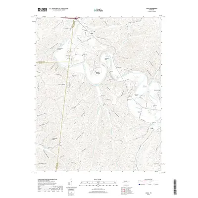
2019 Map of Coble
USGS Topo · Published 2019About this map
The Duck River winds through a landscape of tight hollows and sharp bends in this 2019 survey of the Tennessee interior. Marked by a distinctive network of family-named landmarks, the area preserves the geographic imprint of early settlement patterns, particularly around the small communities of Only and Coble. The river's path is defined by sharp geological features like Horseshoe Bend and Lower Lowe Bend, where the terrain drops into Blue Rock Shoals and Gullet Chute.
Find a feature on this map
122 named features on this map. Tap any name to fly to it.
Don’t see what you’re looking for? This feature index may not catch every label — zoom into the map to look around manually.
Map Details
Editions of this 2019 Coble Map
This is the sole edition of this map. No revisions or reprints were ever made.
Other maps of this area

1936 · Pleasantville
USGS Topo · 1:24,000

1936 · Hurricane Mills
USGS Topo · 1:24,000

1936 · Coble
USGS Topo · 1:24,000

1936 · Beaverdam Springs
USGS Topo · 1:24,000

1936 · Whitfield
USGS Topo · 1:24,000

1936 · Bucksnort
USGS Topo · 1:24,000

1936 · Chestnut Grove
USGS Topo · 1:24,000

1936 · Spot
USGS Topo · 1:24,000

1936 · Lobelville
USGS Topo · 1:24,000
1950 · Chestnut Grove
USGS Topo · 1:24,000