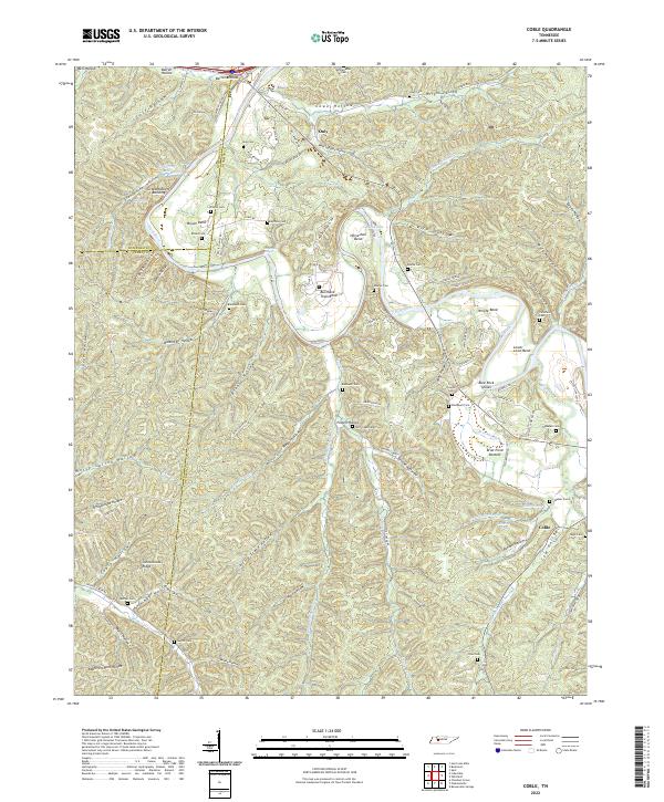
2022 Map of Coble
USGS Topo · Published 2022About this map
Duck River serpentines across this landscape, defining the character of the terrain through a series of dramatic loops including Horseshoe Bend, Burchard Town Bend, and Wright Bend. The topography is a dense network of hollows and ridges, where small settlements like Only and Coble serve as local anchors. Numerous family cemeteries are scattered throughout these valleys, such as McClanahan Cem, Wilkins Cem, and Wolf Creek Cem, providing a detailed record of the area's genealogical history. Significant water features like Big Spring Lake and Blue Rock Shoals further illustrate the river-centric geography of the region. The map also captures several landmark locations such as the Grandmothers Building and the prominent Schoolhouse Ridge, which reflect the community's historical development along the river's winding course.
Find a feature on this map
115 named features on this map. Tap any name to fly to it.
Don’t see what you’re looking for? This feature index may not catch every label — zoom into the map to look around manually.
Map Details
Editions of this 2022 Coble Map
This is the sole edition of this map. No revisions or reprints were ever made.
Other maps of this area

1936 · Pleasantville
USGS Topo · 1:24,000

1936 · Hurricane Mills
USGS Topo · 1:24,000

1936 · Coble
USGS Topo · 1:24,000

1936 · Beaverdam Springs
USGS Topo · 1:24,000

1936 · Whitfield
USGS Topo · 1:24,000

1936 · Bucksnort
USGS Topo · 1:24,000

1936 · Chestnut Grove
USGS Topo · 1:24,000

1936 · Spot
USGS Topo · 1:24,000

1936 · Lobelville
USGS Topo · 1:24,000
1950 · Chestnut Grove
USGS Topo · 1:24,000