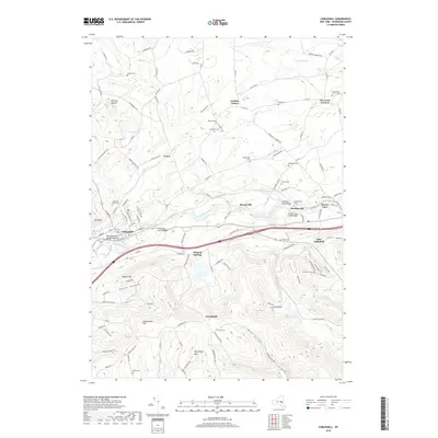
2019 Map of Cobleskill
USGS Topo · Published 2019About this map
Cobleskill Creek carves a central valley through this Schoharie County landscape, serving as a corridor for both the Delaware and Hudson Railroad and modern transport. The village of Cobleskill stands as the primary hub, surrounded by upland settlements and distinct topographic features like Barrack Zourie and Petersburg Mtn. The map reveals a dense network of family and community history, particularly through its numerous burial grounds such as Lawyer Cem, Grosvenors Corners Cem, and the Cobleskill Rural Cem. To the east, the terrain descends toward Howes Cave and Bramanville, where the creek is spanned by the Howes Cave Road Bridge. This topography is defined by sharp ridges and deep hollows, including Mickel Hollow and Ecker Hollow, which have historically constrained development to the narrow valley floors and plateaus like Warnerville Hill.
Find a feature on this map
124 named features on this map. Tap any name to fly to it.
Don’t see what you’re looking for? This feature index may not catch every label — zoom into the map to look around manually.
Map Details
Editions of this 2019 Cobleskill Map
This is the sole edition of this map. No revisions or reprints were ever made.
Other maps of this area

1896 · Fonda
USGS Topo · 1:62,500

1898 · Fonda
USGS Topo · 1:62,500

1898 · Canajoharie
USGS Topo · 1:62,500

1898 · Schoharie
USGS Topo · 1:62,500

1900 · Canajoharie
USGS Topo · 1:62,500

1900 · Schoharie
USGS Topo · 1:62,500

1900 · Schoharie
USGS Topo · 1:31,680

1902 · Canajoharie
USGS Topo · 1:62,500

1902 · Fonda
USGS Topo · 1:62,500

1904 · Richmondville
USGS Topo · 1:62,500