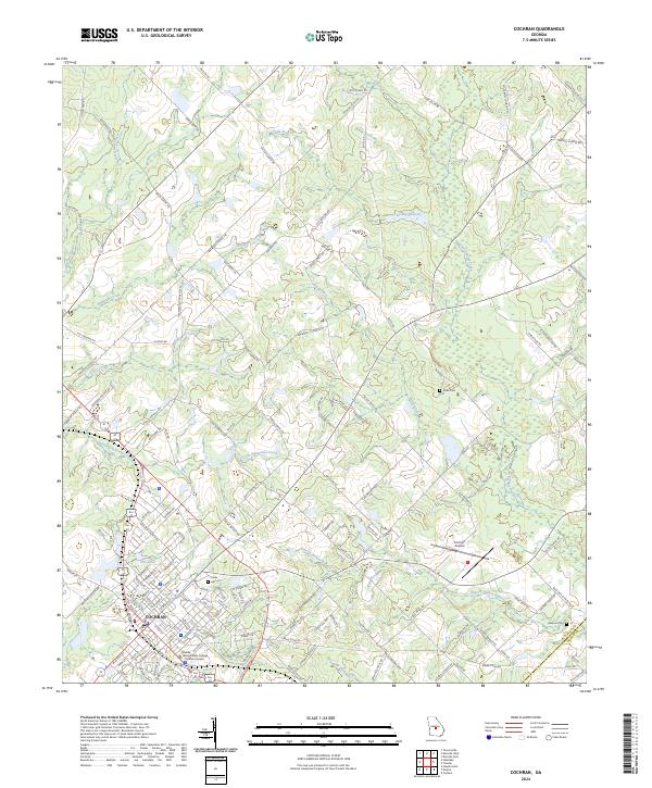
2024 Map of Cochran
USGS Topo · Published 2024About this map
The city of Cochran serves as the focal point of this modern topographic survey, showing the organized grid of the historic downtown area alongside the Middle Georgia State College - Cochran Campus. The landscape is defined by a dense network of watercourses, including Bollinger Creek, South Shellstone Creek, and Gum Swamp Creek, which dictate the local topography and placement of rural roads. To the east of the city, Cochran Airport and a large tract of land under the Farm Service Agency Interest of Georgia highlight the intersection of aviation and regional agricultural management.
Find a feature on this map
142 named features on this map. Tap any name to fly to it.
Don’t see what you’re looking for? This feature index may not catch every label — zoom into the map to look around manually.
Map Details
Editions of this 2024 Cochran Map
This is the sole edition of this map. No revisions or reprints were ever made.
Other maps of this area

1956 · Cochran
USGS Topo · 1:62,500

1956 · Jeffersonville
USGS Topo · 1:62,500

1957 · Macon
USGS Topo · 1:250,000

1958 · Macon
USGS Topo · 1:250,000

1964 · Macon
USGS Topo · 1:250,000

1973 · Tarversville
USGS Topo · 1:24,000
1973 · Hawkinsville
USGS Topo · 1:24,000

1974 · Chester
USGS Topo · 1:24,000

1974 · Danville East
USGS Topo · 1:24,000
1974 · Yonkers
USGS Topo · 1:24,000