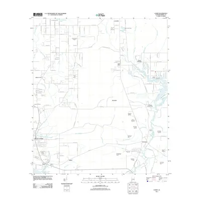
2011 Map of Coden
USGS Topo · Published 2011About this map
Bayou La Batre and the coastal reach of Porters Ville Bay define this corner of the Mobile County shoreline. This early 21st-century landscape reflects a complex transition from traditional maritime life to an energy-driven economy, evidenced by the numerous gas fields such as Bellingrath Gardens Gas Field and industrial infrastructure like the DCP Midstream Gas Gathering Facility. The map captures the established community of Coden, where the Coden Post Office and Catholic Cemetery sit near the water's edge, alongside several other local burial grounds including Oddfellows Cemetery and Cold Springs Cemetery. Inland, the terrain is shaped by a network of waterways including the Fowl River and Bayou Jonas, interspersed with rural settlements like Delchamps and Laurendine. The presence of the Roy E Ray Airport and Pit Development Corporation Pit 4 highlights the mixed-use nature of this coastal Alabama region during this period.
Find a feature on this map
141 named features on this map. Tap any name to fly to it.
Don’t see what you’re looking for? This feature index may not catch every label — zoom into the map to look around manually.
Map Details
Editions of this 2011 Coden Map
This is the sole edition of this map. No revisions or reprints were ever made.
Other maps of this area

1921 · Grand Bay
USGS Topo · 1:62,500

1921 · Delchamps
USGS Topo · 1:62,500

1922 · Mobile
USGS Topo · 1:62,500

1940 · Hollingers Island
USGS Topo · 1:31,680

1940 · Mobile
USGS Topo · 1:62,500

1941 · Cedar Point
USGS Topo · 1:62,500

1941 · Hurley
USGS Topo · 1:62,500

1942 · Theodore
USGS Topo · 1:31,680

1943 · Cedar Point
USGS Topo · 1:62,500

1943 · Theodore
USGS Topo · 1:31,680