
1943 Map of Theodore
USGS Topo · Published 1943About this map
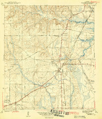
The coastal lowlands and swampy river bottoms of Mobile County are captured here just as the region’s transportation network was maturing. Theodore serves as a central hub, where the Louisville and Nashville and Mobile and Ohio railroads intersect with local thoroughfares like the Gulf and Nashville Trail and Old Louisville Road. This junction marks a critical point of movement for timber and agricultural goods destined for the port. To the east, the landscape transitions into the wet terrain of Hollingers Island, bordered by Middle River and Rattlesnake Bayou.
Find a feature on this map
30 named features on this map. Tap any name to fly to it.
Don’t see what you’re looking for? This feature index may not catch every label — zoom into the map to look around manually.
Map Details
Editions of this 1943 Theodore Map
2 editions found
Other maps of this area

1921 · Grand Bay
USGS Topo · 1:62,500

1921 · Delchamps
USGS Topo · 1:62,500

1922 · Mobile
USGS Topo · 1:62,500

1940 · Hollingers Island
USGS Topo · 1:31,680

1940 · Mobile
USGS Topo · 1:31,680

1940 · Mobile
USGS Topo · 1:62,500

1941 · Cedar Point
USGS Topo · 1:62,500

1941 · Hurley
USGS Topo · 1:62,500

1942 · Theodore
USGS Topo · 1:31,680

1943 · Cedar Point
USGS Topo · 1:62,500