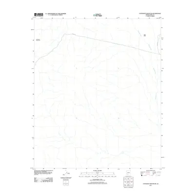
2011 Map of Coffeepot Mountain
USGS Topo · Published 2011About this map
Coffeepot Mountain anchors the northwestern corner of this 2011 survey, overlooking a vast drainage network within the Sonoran Desert. The settlement of Stoa Pitk occupies the northeastern reaches of the map, situated near the headwaters of Hickiwan Wash. This ephemeral watercourse meanders southward through the arid terrain, reflecting the seasonal hydrology critical to this part of Pima County. Infrastructure in this sparsely populated area is defined by utility and transit routes, notably the east-west corridor of Pipeline Rd and the north-south alignment of Indian Rte 13. The absence of dense development highlights a landscape still governed by natural topography and ancestral land use patterns within the Tohono O'odham Nation territory.
Find a feature on this map
5 named features on this map. Tap any name to fly to it.
Don’t see what you’re looking for? This feature index may not catch every label — zoom into the map to look around manually.
Map Details
Editions of this 2011 Coffeepot Mountain Map
This is the sole edition of this map. No revisions or reprints were ever made.
Other maps of this area

1953 · Ajo
USGS Topo · 1:250,000

1957 · Ajo
USGS Topo · 1:250,000

1958 · Ajo
USGS Topo · 1:250,000

1958 · Kaka
USGS Topo · 1:62,500

1958 · Hat Mountain
USGS Topo · 1:62,500

1962 · Ajo
USGS Topo · 1:250,000

1963 · Ajo
USGS Topo · 1:250,000

1963 · Sikort Chuapo Mts
USGS Topo · 1:62,500

1963 · Cimarron Peak
USGS Topo · 1:62,500

1967 · Ajo
USGS Topo · 1:250,000