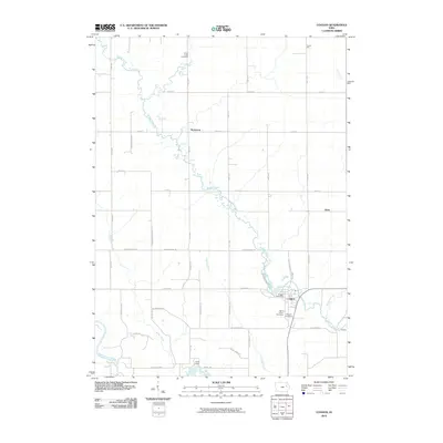
2010 Map of Coggon
USGS Topo · Published 2010About this map
Buffalo Creek winds southeastward through this northern Linn County landscape, serving as a primary drainage corridor toward the Coggon settlement. The town is the central hub of activity, where the Coggon Post Office is situated near several local burial grounds, including Saint Johns Cemetery and Coggon Cemetery. The mapping reflects a structured rural grid defined by roads like Linn Delaware Rd and Robinson Rd, which connect smaller communities and individual farmsteads.
Find a feature on this map
46 named features on this map. Tap any name to fly to it.
Don’t see what you’re looking for? This feature index may not catch every label — zoom into the map to look around manually.
Map Details
Editions of this 2010 Coggon Map
This is the sole edition of this map. No revisions or reprints were ever made.
Other maps of this area

1888 · Marion
USGS Topo · 1:62,500

1889 · Marion
USGS Topo · 1:62,500

1890 · Anamosa
USGS Topo · 1:62,500

1900 · Anamosa
USGS Topo · 1:125,000

1903 · Winthrop
USGS Topo · 1:125,000

1959 · Dubuque
USGS Topo · 1:250,000

1961 · Dubuque
USGS Topo · 1:250,000

1962 · Dubuque
USGS Topo · 1:250,000
1968 · Central City
USGS Topo · 1:24,000
1968 · Lafayette
USGS Topo · 1:24,000