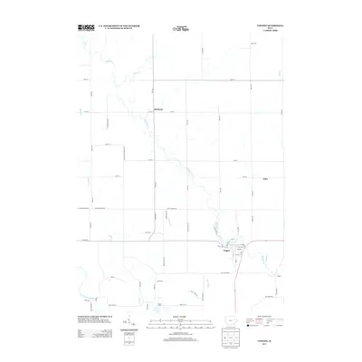
2013 Map of Coggon
USGS Topo · Published 2013About this map
Buffalo Cr meanders southward through the Iowa countryside, serving as a primary drainage corridor for this agricultural landscape. In the southern half of the map, the settlement of Coggon appears as the principal hub, situated near the confluence of local streams and the Wapsipinicon River. The town's grid is clearly defined, showing its relationship to the surrounding road network, including Coggon Rd and Hutchinson Rd.
Find a feature on this map
60 named features on this map. Tap any name to fly to it.
Don’t see what you’re looking for? This feature index may not catch every label — zoom into the map to look around manually.
Map Details
Editions of this 2013 Coggon Map
This is the sole edition of this map. No revisions or reprints were ever made.
Other maps of this area

1888 · Marion
USGS Topo · 1:62,500

1889 · Marion
USGS Topo · 1:62,500

1890 · Anamosa
USGS Topo · 1:62,500

1900 · Anamosa
USGS Topo · 1:125,000

1903 · Winthrop
USGS Topo · 1:125,000

1959 · Dubuque
USGS Topo · 1:250,000

1961 · Dubuque
USGS Topo · 1:250,000

1962 · Dubuque
USGS Topo · 1:250,000
1968 · Central City
USGS Topo · 1:24,000
1968 · Lafayette
USGS Topo · 1:24,000