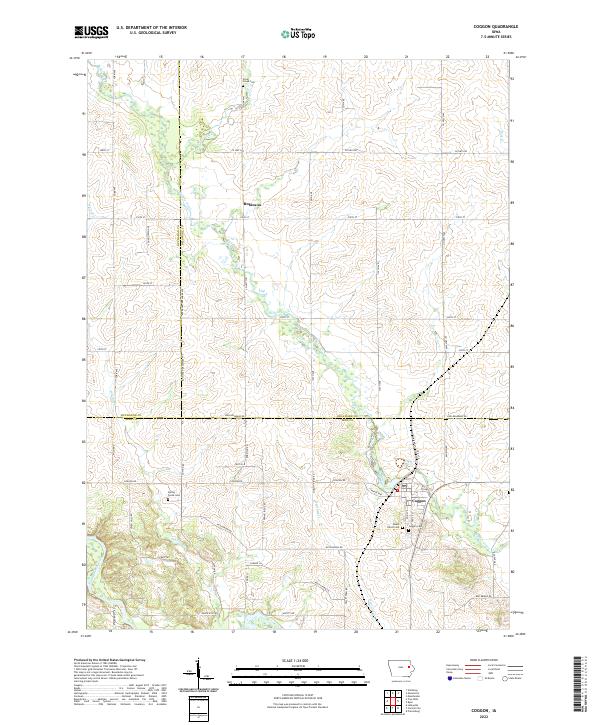
2022 Map of Coggon
USGS Topo · Published 2022About this map
Coggon stands at the heart of this survey, where the convergence of Buffalo Creek and Heatons Creek defines the local drainage pattern in northern Linn County. The landscape is marked by the meeting point of three counties—Linn, Delaware, and Buchanan—creating a unique tri-county border area north of the main settlement. Several established burial grounds, including Mount Olivet Cemetery and Coggon Cemetery, serve as significant anchors for genealogical research in this rural pocket of Iowa.
Find a feature on this map
35 named features on this map. Tap any name to fly to it.
Don’t see what you’re looking for? This feature index may not catch every label — zoom into the map to look around manually.
Map Details
Editions of this 2022 Coggon Map
This is the sole edition of this map. No revisions or reprints were ever made.
Other maps of this area

1888 · Marion
USGS Topo · 1:62,500

1889 · Marion
USGS Topo · 1:62,500

1890 · Anamosa
USGS Topo · 1:62,500

1900 · Anamosa
USGS Topo · 1:125,000

1903 · Winthrop
USGS Topo · 1:125,000

1959 · Dubuque
USGS Topo · 1:250,000

1961 · Dubuque
USGS Topo · 1:250,000

1962 · Dubuque
USGS Topo · 1:250,000
1968 · Central City
USGS Topo · 1:24,000
1968 · Lafayette
USGS Topo · 1:24,000