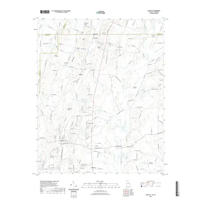
2020 Map of Cohutta
USGS Topo · Published 2020About this map
Prater Mill stands as a focal point in this landscape where Whitfield County, Georgia, meets the Tennessee state line. The terrain is defined by the Tennessee Valley Divide and a series of north-south ridges including Red Clay Ridge and Whites Cut Ridge. This area shows a complex network of springs and small waterways like Coahulla Cr and Wilson Cr that historically supported local agriculture and industry. Significant historical markers include the Council Of Trees Trail and the eponymous settlement of Red Clay, a location of immense importance for its connection to Cherokee history. The presence of Whites Cut and Masters Cut along the rail corridor highlights the engineering required to traverse the Cohutta Ridge and Dry Valley. From the southern village of Varnell to the northern hills, the map documents a mix of rural homesteads, local cemeteries such as Hoskins Cem, and recreational sites like Pratermill Flight Park.
Find a feature on this map
191 named features on this map. Tap any name to fly to it.
Don’t see what you’re looking for? This feature index may not catch every label — zoom into the map to look around manually.
Map Details
Editions of this 2020 Cohutta Map
This is the sole edition of this map. No revisions or reprints were ever made.
Other maps of this area

1886 · Dalton
USGS Topo · 1:125,000

1886 · Cleveland
USGS Topo · 1:125,000

1886 · Ringgold
USGS Topo · 1:125,000

1888 · Chattanooga
USGS Topo · 1:125,000

1892 · Ringgold
USGS Topo · 1:125,000

1892 · Cleveland
USGS Topo · 1:125,000

1892 · Dalton
USGS Topo · 1:125,000

1893 · Chattanooga
USGS Topo · 1:125,000

1895 · Cleveland
USGS Topo · 1:125,000

1897 · Dalton
USGS Topo · 1:125,000