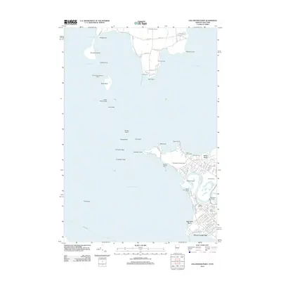
2012 Map of Colchester Point
USGS Topo · Published 2012About this map
Lake Champlain dominates this coastal landscape, where the Winooski River winds through its delta before emptying into the bay south of Colchester Point. The 2012 survey illustrates the dense concentration of summer camps and recreational landmarks along the shoreline, including Camp Hochelaga, Camp Skyland, and Camp Saint Joseph. These sites, along with public spaces like Bernard J Leddy Park and Starr Farm Beach, reflect the region's enduring identity as a seasonal retreat and waterfront community. Further inland, the map serves as a vital record for genealogists, detailing several significant burial grounds such as Holy Cross Cem, Ohavi Zedek Cem, and Mount Calvary Cem. The infrastructure of the era is marked by local aviation and transport hubs, from the Allenholm Airport to the Heineberg Bridge, while the scattered islands of Providence Island and Stave Island emphasize the maritime geography of The Narrows.
Find a feature on this map
98 named features on this map. Tap any name to fly to it.
Don’t see what you’re looking for? This feature index may not catch every label — zoom into the map to look around manually.
Map Details
Editions of this 2012 Colchester Point Map
This is the sole edition of this map. No revisions or reprints were ever made.
Other maps of this area

1894 · Plattsburg
USGS Topo · 1:62,500

1895 · Willsboro
USGS Topo · 1:62,500

1906 · Plattsburg
USGS Topo · 1:62,500

1906 · Burlington
USGS Topo · 1:62,500

1913 · Milton
USGS Topo · 1:48,000

1915 · Milton
USGS Topo · 1:62,500

1919 · Burlington
USGS Topo · 1:62,500

1939 · Plattsburg
USGS Topo · 1:62,500

1941 · Plattsburg
USGS Topo · 1:62,500

1941 · Willsboro
USGS Topo · 1:62,500