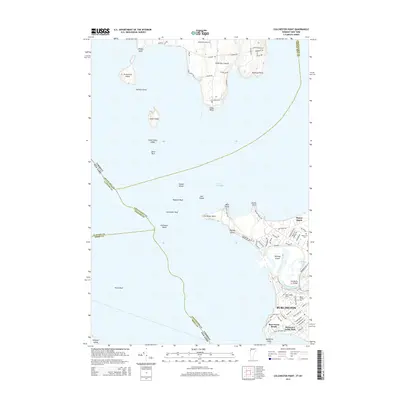
2015 Map of Colchester Point
USGS Topo · Published 2015About this map
Lake Champlain dominates this coastal landscape, serving as the interface between Vermont and New York. The map details the complex shoreline of Burlington, stretching from the residential developments near Starr Farm Beach northward to the mouth of the Winooski River. This area represents a critical point of geography where the river forms Halfmoon Cove and passes under the Heineberg Bridge before entering the lake. On the northern shores, the lower portion of South Hero Island is visible, featuring Allenholm Airport and several family-named points like Robinson Point and Allen Point.
Find a feature on this map
86 named features on this map. Tap any name to fly to it.
Don’t see what you’re looking for? This feature index may not catch every label — zoom into the map to look around manually.
Map Details
Editions of this 2015 Colchester Point Map
This is the sole edition of this map. No revisions or reprints were ever made.
Other maps of this area

1894 · Plattsburg
USGS Topo · 1:62,500

1895 · Willsboro
USGS Topo · 1:62,500

1906 · Plattsburg
USGS Topo · 1:62,500

1906 · Burlington
USGS Topo · 1:62,500

1913 · Milton
USGS Topo · 1:48,000

1915 · Milton
USGS Topo · 1:62,500

1919 · Burlington
USGS Topo · 1:62,500

1939 · Plattsburg
USGS Topo · 1:62,500

1941 · Plattsburg
USGS Topo · 1:62,500

1941 · Willsboro
USGS Topo · 1:62,500