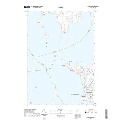
2021 Map of Colchester Point
USGS Topo · Published 2021About this map
Lake Champlain dominates this 2021 study of the Vermont shoreline where the Winooski River meets the bay. The map documents the northern reaches of Burlington and South Burlington, showing a landscape defined by points, reefs, and islands. A notable recreational corridor is the Island Line Trail, which traces the old rail causeway across the water toward South Hero Island.
Find a feature on this map
88 named features on this map. Tap any name to fly to it.
Don’t see what you’re looking for? This feature index may not catch every label — zoom into the map to look around manually.
Map Details
Editions of this 2021 Colchester Point Map
This is the sole edition of this map. No revisions or reprints were ever made.
Other maps of this area

1894 · Plattsburg
USGS Topo · 1:62,500

1895 · Willsboro
USGS Topo · 1:62,500

1906 · Plattsburg
USGS Topo · 1:62,500

1906 · Burlington
USGS Topo · 1:62,500

1913 · Milton
USGS Topo · 1:48,000

1915 · Milton
USGS Topo · 1:62,500

1919 · Burlington
USGS Topo · 1:62,500

1939 · Plattsburg
USGS Topo · 1:62,500

1941 · Plattsburg
USGS Topo · 1:62,500

1941 · Willsboro
USGS Topo · 1:62,500