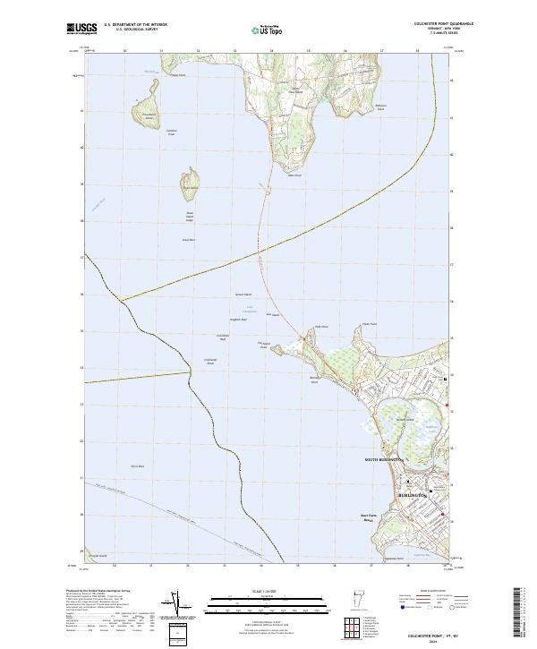
2024 Map of Colchester Point
USGS Topo · Published 2024About this map
Lake Champlain dominates this modern topographical study, where the waters of The Narrows separate the southern tip of South Hero Island from the mainland at Colchester Point. The landscape is defined by the transition from the open lake to the dense suburban street grids of Burlington and South Burlington. A concentration of local history is visible in the cluster of burial grounds near the Winooski River delta, including Holy Cross Cem, Calvary Cem, and Ohavi Zedek Cem. The area’s recreational and conservation value is evident through the Island Line Trl, which navigates the causeway toward Allen Point, and the protected marshes of Halfmoon Cove. Numerous islands and hazards such as Colchester Shoal and Stave Island Ledge illustrate the intricate maritime geography that has long influenced navigation between the Vermont shore and the Ausable River delta.
Find a feature on this map
91 named features on this map. Tap any name to fly to it.
Don’t see what you’re looking for? This feature index may not catch every label — zoom into the map to look around manually.
Map Details
Editions of this 2024 Colchester Point Map
This is the sole edition of this map. No revisions or reprints were ever made.
Other maps of this area

1894 · Plattsburg
USGS Topo · 1:62,500

1895 · Willsboro
USGS Topo · 1:62,500

1906 · Plattsburg
USGS Topo · 1:62,500

1906 · Burlington
USGS Topo · 1:62,500

1913 · Milton
USGS Topo · 1:48,000

1915 · Milton
USGS Topo · 1:62,500

1919 · Burlington
USGS Topo · 1:62,500

1939 · Plattsburg
USGS Topo · 1:62,500

1941 · Plattsburg
USGS Topo · 1:62,500

1941 · Willsboro
USGS Topo · 1:62,500