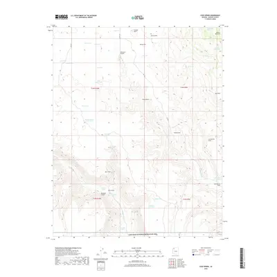
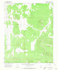
2018 Map of Cold Spring
USGS Topo · Published 2018About this map
The Lake Mead National Recreation Area forms the southern boundary of this high desert landscape, where water remains the most critical resource for movement and habitation. The map reveals an intricate network of tanks, springs, and ponds necessary for life in this arid terrain, ranging from the well-known Cold Spring and Death Valley Spring to specialized catchment points like Sand Flat Tank and Red Bluff Tank. The geography is defined by significant drainage systems and overlooks, including Whitmore Canyon and Parashant Canyon. Prominent landmarks such as Griffith Knoll and the Sawmill Mountains rise above the flats, while deep cuts like Road Canyon provide natural corridors through the varied elevations. These features reflect a landscape where survival and travel are dictated by the location of intermittent water sources and the natural breaks in the canyon walls.
Find a feature on this map
44 named features on this map. Tap any name to fly to it.
Don’t see what you’re looking for? This feature index may not catch every label — zoom into the map to look around manually.
Map Details
Editions of this 2018 Cold Spring Map
This is the sole edition of this map. No revisions or reprints were ever made.
Other maps of this area

1886 · Mt. Trumbull
USGS Topo · 1:250,000

1892 · Mt. Trumbull
USGS Topo · 1:250,000

1953 · Grand Canyon
USGS Topo · 1:250,000

1957 · Grand Canyon
USGS Topo · 1:250,000

1958 · Grand Canyon
USGS Topo · 1:250,000

1960 · Grand Canyon
USGS Topo · 1:250,000
1967 · Yellow John Mtn.
USGS Topo · 1:24,000
1967 · Whitmore Rapids
USGS Topo · 1:24,000
1967 · Whitmore Point
USGS Topo · 1:24,000
1967 · Mt. Trumbull NW
USGS Topo · 1:24,000