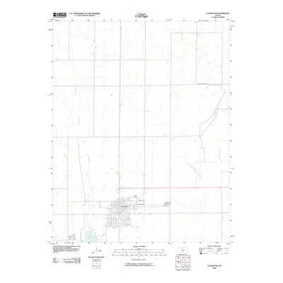
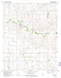
2009 Map of Coldwater
USGS Topo · Published 2009About this map
Coldwater sits at a geographic crossroads in south-central Kansas, where the gridiron streets of the town meet the sinuous paths of Cavalry Creek and West Branch Nescatunga Creek. This 2009 survey highlights the relationship between the local settlement and the surrounding plains, including the expansive Lake Coldwater just south of the main residential area. The town layout is clearly defined by named thoroughfares such as Maple St, Cottonwood ST, and 10th St, showing the extent of development in the early 21st century. To the east, Crown Hill Cemetery serves as a vital anchor for genealogists and local historians tracing regional family roots, while the presence of Stark Airport on the northern edge of town indicates the community's connection to regional aviation. The map provides a precise look at the rural landscape and transportation network, including the Wilmore County Rd corridor.
Find a feature on this map
12 named features on this map. Tap any name to fly to it.
Don’t see what you’re looking for? This feature index may not catch every label — zoom into the map to look around manually.
Map Details
Editions of this 2009 Coldwater Map
This is the sole edition of this map. No revisions or reprints were ever made.
Other maps of this area

1892 · Coldwater
USGS Topo · 1:125,000

1955 · Pratt
USGS Topo · 1:250,000

1959 · Pratt
USGS Topo · 1:250,000

1979 · Coldwater
USGS Topo · 1:24,000

1979 · East Kiowa Creek South
USGS Topo · 1:24,000
1979 · East Kiowa Creek North
USGS Topo · 1:24,000

1979 · Protection NE
USGS Topo · 1:24,000
1980 · Nescatunga Creek North
USGS Topo · 1:24,000
1980 · Protection
USGS Topo · 1:24,000
1980 · Wilmore
USGS Topo · 1:24,000