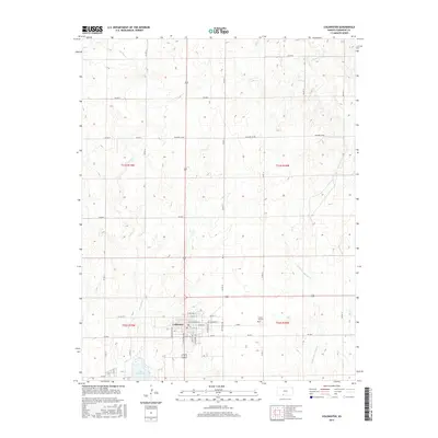
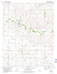
2016 Map of Coldwater
USGS Topo · Published 2016About this map
Coldwater serves as the focal point of this Comanche County survey, revealing the structured grid of the town site near the intersection of several regional routes. The map documents the local street plan, including Metropolis Ave, S Baltimore Ave, and E Main St, providing a clear record of the community's layout and residential expansion. East of the town center, Crown Hill Cem sits on an elevated plot, while to the south, the expansive Lake Coldwater provides a significant water feature in this prairie landscape. The surrounding terrain is defined by a network of seasonal watercourses, including Cavalry Cr, Mule Cr, and the W Br Nescatunga Cr. These drainages, along with the numerous county roads like Wilmore Co Rd, illustrate the rural connectivity of the High Plains, where the landscape is divided into the large sections of townships T31S and T32S.
Find a feature on this map
41 named features on this map. Tap any name to fly to it.
Don’t see what you’re looking for? This feature index may not catch every label — zoom into the map to look around manually.
Map Details
Editions of this 2016 Coldwater Map
This is the sole edition of this map. No revisions or reprints were ever made.
Other maps of this area

1892 · Coldwater
USGS Topo · 1:125,000

1955 · Pratt
USGS Topo · 1:250,000

1959 · Pratt
USGS Topo · 1:250,000

1979 · Coldwater
USGS Topo · 1:24,000

1979 · East Kiowa Creek South
USGS Topo · 1:24,000
1979 · East Kiowa Creek North
USGS Topo · 1:24,000

1979 · Protection NE
USGS Topo · 1:24,000
1980 · Nescatunga Creek North
USGS Topo · 1:24,000
1980 · Protection
USGS Topo · 1:24,000
1980 · Wilmore
USGS Topo · 1:24,000