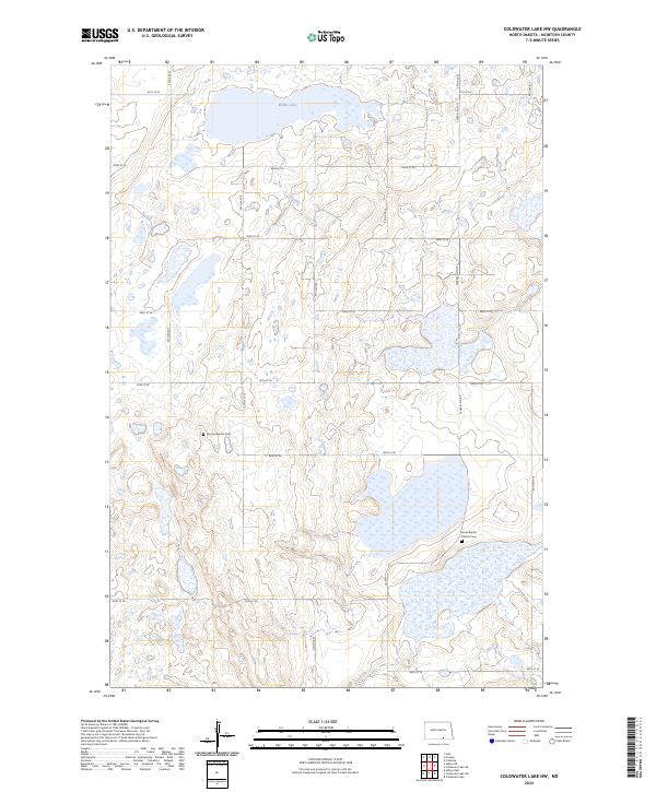
2024 Map of Coldwater Lake NW
USGS Topo · Published 2024About this map
McIntosh County Waterfowl Production Area dominates the landscape of this McIntosh County quadrangle, where a complex network of wetlands and small basins defines the prairie terrain. The map highlights the intersection of public conservation land and early German-Russian settlement history, evidenced by the presence of the German Baptist Cem and Berlin Baptist Church Cem. These sites, situated along the section lines of 85th St SE and 88th St SE, provide a critical reference for genealogists tracing families in the southern part of the state. Miller Lake serves as a prominent water feature in the northern sections, while the road network, including Federal Aid Rd and Co Rd 9, follows the rigid grid of the Public Land Survey System typical of the Great Plains.
Find a feature on this map
20 named features on this map. Tap any name to fly to it.
Don’t see what you’re looking for? This feature index may not catch every label — zoom into the map to look around manually.
Map Details
Editions of this 2024 Coldwater Lake NW Map
This is the sole edition of this map. No revisions or reprints were ever made.
Other maps of this area

1953 · Jamestown
USGS Topo · 1:250,000

1956 · Jamestown
USGS Topo · 1:250,000

1982 · Coldwater Lake NW
USGS Topo · 1:24,000

1982 · Guyson
USGS Topo · 1:24,000

1982 · Coldwater Lake NE
USGS Topo · 1:24,000

1982 · Fredonia
USGS Topo · 1:24,000

1982 · Ashley East
USGS Topo · 1:24,000
1982 · Coldwater Lake SW
USGS Topo · 1:24,000

1982 · Ashley NE
USGS Topo · 1:24,000
1982 · Coldwater Lake
USGS Topo · 1:24,000