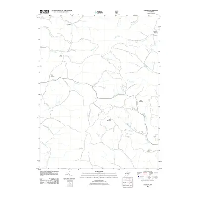
2011 Map of Colebank
USGS Topo · Published 2011About this map
Colebank and the Kasson Post Office anchor a landscape defined by high ridges and winding creek valleys in this northern West Virginia survey. The terrain is marked by significant elevations including Texas Mountain, Pifer Mountain, and the long stretch of Laurel Mountain to the south. Local heritage is preserved in sites like the Shiloh Cemetery and Mount Cassell Cemetery, which sit near the headwaters of Raccoon Creek and Brushy Fork. The drainage pattern is complex, with Licking Creek and Sandy Creek carving through the hills, while smaller settlements like Hovatter appear near the eastern edge near Jacobs Run. The road network consists primarily of county routes that follow these natural contours, connecting remote farmsteads and landmarks such as Mount Zion on the Mount Zion Ridge.
Find a feature on this map
64 named features on this map. Tap any name to fly to it.
Don’t see what you’re looking for? This feature index may not catch every label — zoom into the map to look around manually.
Map Details
Editions of this 2011 Colebank Map
This is the sole edition of this map. No revisions or reprints were ever made.
Other maps of this area

1886 · St. George
USGS Topo · 1:125,000

1891 · St. George
USGS Topo · 1:125,000

1907 · Thornton
USGS Topo · 1:62,500

1907 · Kingwood
USGS Topo · 1:62,500

1907 · Belington
USGS Topo · 1:62,500

1908 · Parsons
USGS Topo · 1:62,500

1925 · Kingwood
USGS Topo · 1:62,500

1926 · Thornton
USGS Topo · 1:62,500

1926 · Parsons
USGS Topo · 1:62,500

1927 · Belington
USGS Topo · 1:62,500