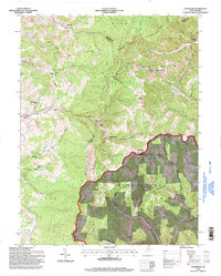
1995 Map of Colebank
USGS Topo · Published 1998About this map
Valley Furnace and the small settlements of Kasson and Colebank anchor this mid-1990s look at the crossroads of Barbour, Preston, and Tucker Counties. The landscape is defined by the massive spine of Laurel Mountain, which separates the drainage of Sandy Creek from the eastern slopes of Licking Creek. Local life is clearly mapped through a network of rural institutions, from Union Chapel and Shiloh Ch to the Digman Sch and Murphy Sch, indicating a well-established community structure amidst the timbered slopes.
Find a feature on this map
43 named features on this map. Tap any name to fly to it.
Don’t see what you’re looking for? This feature index may not catch every label — zoom into the map to look around manually.
Map Details
Editions of this 1995 Colebank Map
This is the sole edition of this map. No revisions or reprints were ever made.
Other maps of this area

1886 · St. George
USGS Topo · 1:125,000

1891 · St. George
USGS Topo · 1:125,000

1907 · Thornton
USGS Topo · 1:62,500

1907 · Kingwood
USGS Topo · 1:62,500

1907 · Belington
USGS Topo · 1:62,500

1908 · Parsons
USGS Topo · 1:62,500

1925 · Kingwood
USGS Topo · 1:62,500

1926 · Thornton
USGS Topo · 1:62,500

1926 · Parsons
USGS Topo · 1:62,500

1927 · Belington
USGS Topo · 1:62,500