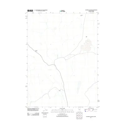
2011 Map of Coleman Canyon
USGS Topo · Published 2011About this map
Toney Ranch sits at the heart of this high-desert landscape in northern Washoe County, where ranching life adapts to the seasonal ebbs and flows of water. The presence of Toney Reservoir is critical in this arid environment, providing a managed water source for livestock across the surrounding basins. This region is defined by broad, high-elevation plains such as Antelope Flat to the north and Macy Flat to the east, which offer clear evidence of the vast grazing lands that have supported local ranching operations for generations. The titular Coleman Canyon cuts through the western portion of the sheet, illustrating the drainage patterns that direct sparse rainfall toward the central ranching hub.
Find a feature on this map
5 named features on this map. Tap any name to fly to it.
Don’t see what you’re looking for? This feature index may not catch every label — zoom into the map to look around manually.
Map Details
Editions of this 2011 Coleman Canyon Map
This is the sole edition of this map. No revisions or reprints were ever made.
Other maps of this area

1889 · Long Valley
USGS Topo · 1:250,000

1954 · Vya
USGS Topo · 1:250,000

1955 · Adel
USGS Topo · 1:250,000

1957 · Adel
USGS Topo · 1:250,000

1958 · Vya
USGS Topo · 1:250,000

1958 · Adel
USGS Topo · 1:250,000

1962 · Vya
USGS Topo · 1:250,000

1962 · Adel
USGS Topo · 1:250,000

1966 · Bald Mountain
USGS Topo · 1:24,000
1966 · Rye Creek
USGS Topo · 1:24,000