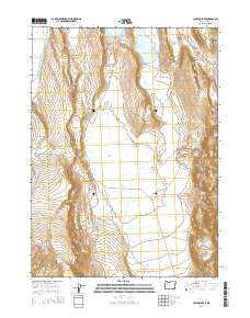
2014 Map of Coleman Lake
USGS Topo · Published 2014About this map
Coleman Valley and its high desert hydrology define this landscape in eastern Lake County. The map documents a complex network of seasonal water sources and drainage patterns, anchored by Coleman Lake and the nearby Greaser Lake. For researchers of western land use, the presence of named water improvements like Greaser Reservoir and Cahill Reservoir, alongside natural outflows such as Twentymile Slough, illustrates the vital importance of water management in this arid region.
Find a feature on this map
30 named features on this map. Tap any name to fly to it.
Don’t see what you’re looking for? This feature index may not catch every label — zoom into the map to look around manually.
Map Details
Editions of this 2014 Coleman Lake Map
This is the sole edition of this map. No revisions or reprints were ever made.
Other maps of this area

1889 · Long Valley
USGS Topo · 1:250,000

1954 · Vya
USGS Topo · 1:250,000

1955 · Adel
USGS Topo · 1:250,000

1957 · Adel
USGS Topo · 1:250,000

1958 · Vya
USGS Topo · 1:250,000

1958 · Adel
USGS Topo · 1:250,000

1962 · Vya
USGS Topo · 1:250,000

1962 · Adel
USGS Topo · 1:250,000
1966 · Barrel Springs
USGS Topo · 1:24,000
1966 · Little Coleman Canyon
USGS Topo · 1:24,000