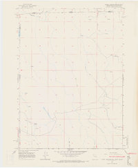
1966 Map of Barrel Springs
USGS Topo · Published 1968About this map
Barrel Springs and the surrounding high desert terrain define this transition zone where the borders of Nevada, Oregon, and California converge. Mapped in the mid-1960s, the landscape is marked by a network of intermittent water sources and ephemeral drainage patterns, including Twelvemile Creek and the shallow basins of Twin Lakes. The presence of a Gravel Pit and numerous unpaved routes, labeled simply as Trail or Jeep, suggests a working landscape of resource extraction and rugged overland travel. This survey meticulously details the administrative boundaries of the tri-state area, documenting the intersecting lines of Washoe County, Lake County, and Modoc County during a period of minimal development in this corner of the Great Basin.
Find a feature on this map
12 named features on this map. Tap any name to fly to it.
Don’t see what you’re looking for? This feature index may not catch every label — zoom into the map to look around manually.
Map Details
Editions of this 1966 Barrel Springs Map
2 editions found
Other maps of this area

1886 · Alturas
USGS Topo · 1:250,000

1889 · Long Valley
USGS Topo · 1:250,000

1892 · Alturas
USGS Topo · 1:250,000

1954 · Vya
USGS Topo · 1:250,000

1954 · Alturas
USGS Topo · 1:250,000

1955 · Klamath Falls
USGS Topo · 1:250,000

1955 · Adel
USGS Topo · 1:250,000

1957 · Adel
USGS Topo · 1:250,000

1958 · Alturas
USGS Topo · 1:250,000

1958 · Klamath Falls
USGS Topo · 1:250,000