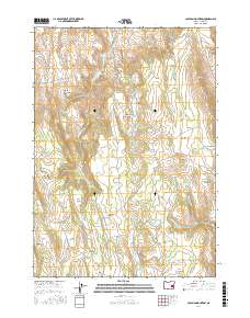
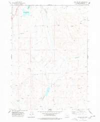
2017 Map of Coleman Mountain
USGS Topo · Published 2017About this map
The Stinkingwater Mountains dominate this high-desert portion of Harney County, Oregon, providing a detailed look at a landscape defined by significant elevation changes and seasonal water sources. The map reveals a complex topography of volcanic ridges and broad basins, including Griffin Basin and the Stinkingwater Basin. Named features like Jones and Ausmus Flat and Indian Garden suggest a history of localized land use and historical landmarks in an area where water is the primary driver of placement. High points such as Coleman Mountain, Bald Mtn, and the distinctive Buzzard Ridge overlook a network of intermittent drainages like Stinkingwater Cr and Little Crane Cr. This survey is particularly useful for identifying specific named springs, such as Mountain Ash Springs and Bootleg Spring, which are critical identifiers for navigating this arid terrain.
Find a feature on this map
32 named features on this map. Tap any name to fly to it.
Don’t see what you’re looking for? This feature index may not catch every label — zoom into the map to look around manually.
Map Details
Editions of this 2017 Coleman Mountain Map
This is the sole edition of this map. No revisions or reprints were ever made.
Other maps of this area

1955 · Burns
USGS Topo · 1:250,000

1958 · Burns
USGS Topo · 1:250,000

1959 · Burns
USGS Topo · 1:250,000

1960 · Crane
USGS Topo · 1:62,500

1968 · Venator
USGS Topo · 1:62,500
1972 · Dunnean
USGS Topo · 1:24,000
1972 · Tin Can Ridge
USGS Topo · 1:24,000
1973 · Upton Mountain
USGS Topo · 1:24,000

1973 · Mahon Creek
USGS Topo · 1:24,000
1977 · Bartlett Mtn
USGS Topo · 1:24,000