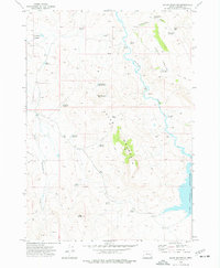
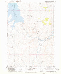
1973 Map of Upton Mountain
USGS Topo · Published 1977About this map
Upton Mountain dominates this portion of Harney County, serving as a high-desert anchor in a landscape defined by seasonal water management and grazing. The 1970s terrain is marked by a complex network of man-made catchments including Upton Mountain Reservoir No 1, Drinkwater Reservoir No 2, and Altnow Gap Reservoir, illustrating the critical importance of water storage in the Oregon interior. To the east, the Malheur River flows toward the extensive Warm Springs Reservoir, while the western slopes drain into Little Stinkingwater Creek. Remnants of local land use are visible at Shurtz Field and Upton Cabin, connected by an intricate system of primitive roads and a Jeep Trail that traverse the basalt plateaus of the Carey Tables. Numerous named water sources like Buskirk Spring and Alkali Spring provide a granular look at the historical hydrology relied upon by local ranchers.
Find a feature on this map
32 named features on this map. Tap any name to fly to it.
Don’t see what you’re looking for? This feature index may not catch every label — zoom into the map to look around manually.
Map Details
Editions of this 1973 Upton Mountain Map
This is the sole edition of this map. No revisions or reprints were ever made.
Other maps of this area

1955 · Burns
USGS Topo · 1:250,000

1958 · Burns
USGS Topo · 1:250,000

1959 · Burns
USGS Topo · 1:250,000

1966 · Beulah
USGS Topo · 1:62,500

1968 · Drewsey
USGS Topo · 1:62,500
1977 · Bartlett Mtn
USGS Topo · 1:24,000
1978 · Selle Gap
USGS Topo · 1:24,000

1978 · Stinkingwater Mountains
USGS Topo · 1:100,000
1979 · Coleman Mtn
USGS Topo · 1:24,000
1979 · Winnemucca Creek
USGS Topo · 1:24,000