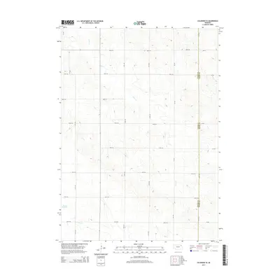
2014 Map of Coleridge SE
USGS Topo · Published 2014About this map
E Bow Cr carves a winding path through the rolling agricultural landscape of northern Nebraska, defining much of the drainage pattern for this portion of Clark Township. The terrain is dominated by a systematic grid of section roads, where routes like 882nd Rd and 876th Rd facilitate movement across the rural acreage. Near the western edge of the survey, the Hansen Reservoir provides a localized water source, while further south, the headwaters of N Logan Cr begin to emerge. The map also delineates the jurisdictional boundary between Cedar Co and Dixon Co, a significant marker for local genealogists and land researchers tracing property records across county lines in this sparsely settled region.
Find a feature on this map
17 named features on this map. Tap any name to fly to it.
Don’t see what you’re looking for? This feature index may not catch every label — zoom into the map to look around manually.
Map Details
Editions of this 2014 Coleridge SE Map
This is the sole edition of this map. No revisions or reprints were ever made.
Other maps of this area

1898 · Elk Point
USGS Topo · 1:125,000

1901 · Elk Point
USGS Topo · 1:125,000

1907 · Elk Point
USGS Topo · 1:125,000

1955 · Sioux City
USGS Topo · 1:250,000

1958 · Sioux City
USGS Topo · 1:250,000

1959 · Sioux City
USGS Topo · 1:250,000

1964 · Martinsburg SW
USGS Topo · 1:24,000

1964 · Maskell
USGS Topo · 1:24,000
1967 · Concord
USGS Topo · 1:24,000

1968 · Obert
USGS Topo · 1:24,000