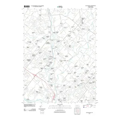
2010 Map of Collegeville
USGS Topo · Published 2010About this map
Perkiomen Creek defines the central axis of this landscape, its waters once harnessed by the Collegeville Dam and crossed by the historic Perkiomen Bridge. By 2010, the area shows a complex layering of suburban expansion and long-standing institutions, most notably the State Correctional Institution at Graterford. A deep-seated religious heritage is evident in the numerous burial grounds, such as the Augustus Lutheran Cemetery in Trappe and the Upper Skippack Mennonite Cemetery near Creamery. Local transportation and landmarks range from the Perkiomen Valley Airport to the Audubon Shrine near the southern edge of the sheet. Modern residential enclaves like Crestview at Skippack and Trappe Meadows sit adjacent to older village centers, illustrating the evolving character of Montgomery County.
Find a feature on this map
162 named features on this map. Tap any name to fly to it.
Don’t see what you’re looking for? This feature index may not catch every label — zoom into the map to look around manually.
Map Details
Editions of this 2010 Collegeville Map
This is the sole edition of this map. No revisions or reprints were ever made.
Other maps of this area

1888 · Quakertown
USGS Topo · 1:62,500

1890 · Quakertown
USGS Topo · 1:62,500

1894 · Quakertown
USGS Topo · 1:62,500

1894 · Norristown
USGS Topo · 1:62,500

1895 · Norristown
USGS Topo · 1:62,500

1896 · Norristown
USGS Topo · 1:62,500

1902 · Boyertown
USGS Topo · 1:62,500

1906 · Phoenixville
USGS Topo · 1:62,500

1942 · Norristown
USGS Topo · 1:125,000
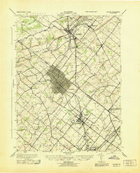
1943 · Telford
USGS Topo · 1:31,680
Featured Places
- Limerick Township, PA
- Phoenixville, PA
- Skippack Township, PA
- Worcester Township, PA
- Perkiomen Township, PA