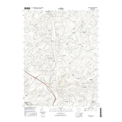
2016 Map of Collegeville
USGS Topo · Published 2016About this map
Perkiomen Creek and Skippack Creek converge in this densely settled portion of Montgomery County, where suburban development intermingles with long-standing institutional and religious landmarks. The map highlights the academic grounds of Ursinus Coll in Collegeville, a central hub surrounded by a network of historic boroughs including Trappe, Schwenksville, and Skippack. The landscape is notably marked by its diverse religious heritage, evidenced by numerous burial grounds such as the Upper Skippack Mennonite Cem, Lower Providence Presbyterian Cem, and the Augustus Lutheran Cem.
Find a feature on this map
329 named features on this map. Tap any name to fly to it.
Don’t see what you’re looking for? This feature index may not catch every label — zoom into the map to look around manually.
Map Details
Editions of this 2016 Collegeville Map
This is the sole edition of this map. No revisions or reprints were ever made.
Other maps of this area

1888 · Quakertown
USGS Topo · 1:62,500

1890 · Quakertown
USGS Topo · 1:62,500

1894 · Quakertown
USGS Topo · 1:62,500

1894 · Norristown
USGS Topo · 1:62,500

1895 · Norristown
USGS Topo · 1:62,500

1896 · Norristown
USGS Topo · 1:62,500

1902 · Boyertown
USGS Topo · 1:62,500

1906 · Phoenixville
USGS Topo · 1:62,500

1942 · Norristown
USGS Topo · 1:125,000
1943 · Telford
USGS Topo · 1:31,680
Featured Places
- Limerick Township, PA
- Phoenixville, PA
- Skippack Township, PA
- Worcester Township, PA
- Perkiomen Township, PA