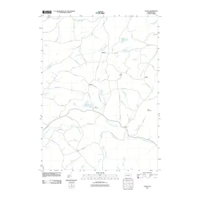
2010 Map of Colley
USGS Topo · Published 2010About this map
Wilmot and the surrounding rural landscape of Bradford County are defined by a network of creeks and small crossroads settlements. This 2010 survey illustrates a primarily agricultural and forested area where the North Branch Mehoopany Creek winds through the southern half of the quadrangle. Distinctive local landmarks include the Pleasant Valley Fruit Farm and the controlled waters of Saxe Pond, held by the Saxe Pond Dam. The terrain rises to Tyler Mountain, while drainage patterns are shaped by numerous named runs such as Wolf Run and Rock Cabin Run. The map provides a look at the modern road network, including Dutch Mountain Rd and Reaser Mountain Rd, which connect small hamlets like Cumiskey, Ellwell, and Colley across this corner of Pennsylvania.
Find a feature on this map
69 named features on this map. Tap any name to fly to it.
Don’t see what you’re looking for? This feature index may not catch every label — zoom into the map to look around manually.
Map Details
Editions of this 2010 Colley Map
This is the sole edition of this map. No revisions or reprints were ever made.
Other maps of this area

1891 · Harveys Lake
USGS Topo · 1:62,500

1893 · Harvey Lake
USGS Topo · 1:62,500

1934 · Laporte
USGS Topo · 1:62,500

1943 · Monroeton
USGS Topo · 1:62,500

1945 · Meshoppen
USGS Topo · 1:62,500

1945 · Jenningsville
USGS Topo · 1:24,000

1945 · Laceyville
USGS Topo · 1:24,000

1946 · Dutch Mtn
USGS Topo · 1:24,000

1947 · Jenningsville
USGS Topo · 1:31,680
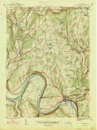
1947 · Laceyville
USGS Topo · 1:24,000
Featured Places
- Wilmot Township, PA
- Colley Township, PA
- Ellwell, Wilmot Township
- Albany Township, PA
- Cumiskey, Wilmot Township