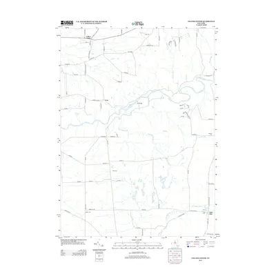
2013 Map of Collins Center
USGS Topo · Published 2013About this map
Cattaraugus Cr carves a deep path through the landscape of western New York, forming the central geographic feature of this 2013 survey. The settlement of Collins Center sits in the northwest, serving as a local hub near Clear Cr. This era shows a rural landscape defined by family-named cemeteries and agricultural roads, with Zoar Bridge providing a critical crossing over the creek. The map details a network of waterways including Waterman Brook, Coon Brook, and Derby Brook that feed into the larger creek system. In the southeast, the village of East Otto is depicted with its local Post Office and nearby E Otto Cem. For genealogists, the map is particularly useful for locating small burial grounds like Knight Cem, Brooklyn Cem, and Barber Cem, which are scattered throughout the hills and valleys of this rural region.
Find a feature on this map
73 named features on this map. Tap any name to fly to it.
Don’t see what you’re looking for? This feature index may not catch every label — zoom into the map to look around manually.
Map Details
Editions of this 2013 Collins Center Map
This is the sole edition of this map. No revisions or reprints were ever made.
Other maps of this area

1905 · Eden
USGS Topo · 1:62,500

1907 · Eden
USGS Topo · 1:62,500

1923 · Cattaraugus
USGS Topo · 1:62,500

1924 · Ellicottville
USGS Topo · 1:62,500

1925 · Springville
USGS Topo · 1:62,500

1938 · Cattaraugus
USGS Topo · 1:62,500

1941 · Cattaraugus
USGS Topo · 1:62,500

1941 · Ellicottville
USGS Topo · 1:62,500

1944 · Eden
USGS Topo · 1:62,500

1944 · North Collins
USGS Topo · 1:31,680