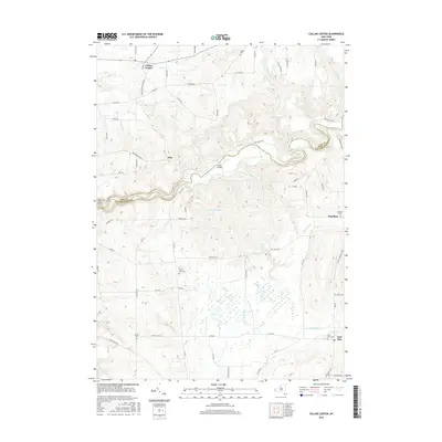
2016 Map of Collins Center
USGS Topo · Published 2016About this map
Cattaraugus Creek carves a deep, winding path through the landscape, forming a natural boundary between Erie and Cattaraugus counties. The 2016 topography highlights the significant relief of the Zoar Valley area, where steep slopes and dramatic bends in the creek define the local geography. Human settlement is concentrated in small communities like Collins Center in the north and East Otto in the southeast, connected by a network of rural roads such as Zoar Valley Rd and Gowanda Zoar Rd.
Find a feature on this map
70 named features on this map. Tap any name to fly to it.
Don’t see what you’re looking for? This feature index may not catch every label — zoom into the map to look around manually.
Map Details
Editions of this 2016 Collins Center Map
This is the sole edition of this map. No revisions or reprints were ever made.
Other maps of this area

1905 · Eden
USGS Topo · 1:62,500

1907 · Eden
USGS Topo · 1:62,500

1923 · Cattaraugus
USGS Topo · 1:62,500

1924 · Ellicottville
USGS Topo · 1:62,500

1925 · Springville
USGS Topo · 1:62,500

1938 · Cattaraugus
USGS Topo · 1:62,500

1941 · Cattaraugus
USGS Topo · 1:62,500

1941 · Ellicottville
USGS Topo · 1:62,500

1944 · Eden
USGS Topo · 1:62,500

1944 · North Collins
USGS Topo · 1:31,680