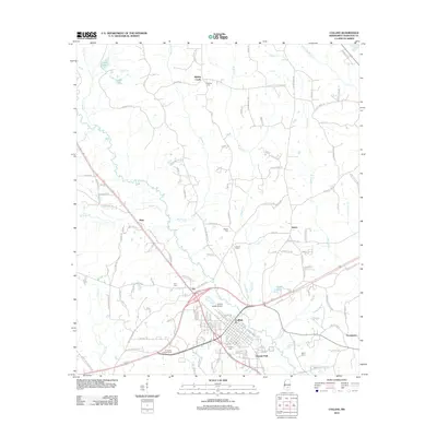
2012 Map of Collins
USGS Topo · Published 2012About this map
Okatoma Creek flows south past the city of Collins, anchoring a landscape where modern aviation and local heritage converge. This survey reflects the development of Covington County in the early twenty-first century, showing the established grid of Collins alongside the Collins Jaycee Airport and the nearby Covington Lookout Tower. The settlement patterns follow both the winding paths of rural roads like Sellers Rd and the larger corridors connecting outlying communities. Small, named settlements such as Mish, Ora, and Salem are interspersed with numerous family-named burial grounds, including Blakely Cemetery and Kola Cemetery. To the north, the waters of Legion Lake and Chain Lake provide a sharp contrast to the dense network of tributaries like Blakely Creek and Rogers Creek that drain the timbered uplands.
Find a feature on this map
124 named features on this map. Tap any name to fly to it.
Don’t see what you’re looking for? This feature index may not catch every label — zoom into the map to look around manually.
Map Details
Editions of this 2012 Collins Map
This is the sole edition of this map. No revisions or reprints were ever made.
Other maps of this area

1953 · Hattiesburg
USGS Topo · 1:250,000

1958 · Hattiesburg
USGS Topo · 1:250,000

1964 · Seminary
USGS Topo · 1:24,000

1965 · Hot Coffee
USGS Topo · 1:24,000

1974 · Lone Star
USGS Topo · 1:24,000

1974 · Williamsburg
USGS Topo · 1:24,000

1974 · Collins
USGS Topo · 1:24,000

1974 · Lake Mike Connor
USGS Topo · 1:24,000

1975 · Taylorsville
USGS Topo · 1:24,000

1975 · Mize
USGS Topo · 1:24,000