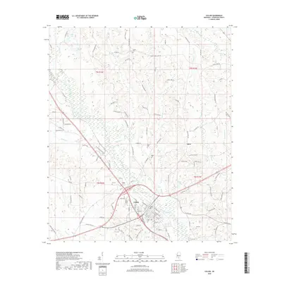
2018 Map of Collins
USGS Topo · Published 2018About this map
Okatoma Creek winds through the heart of this Covington County landscape, shaping the development of Collins and the nearby settlements of Ora and Salem. This 2018 survey reveals a territory marked by a dense network of country roads and family-named landmarks, reflecting generations of residency in southern Mississippi. The concentration of burial sites, such as Kola Cem, Collins Cem, and Rogers Cem, provides a significant inventory for genealogical research. The map illustrates how the terrain alternates between well-drained upland ridges and low-lying areas like the Ora Swamp. Distinctive local markers including Blakely Ch and Salem Ch serve as anchors for these rural communities, while water features like Legion Lake and Gibson Lake dot the countryside.
Find a feature on this map
123 named features on this map. Tap any name to fly to it.
Don’t see what you’re looking for? This feature index may not catch every label — zoom into the map to look around manually.
Map Details
Editions of this 2018 Collins Map
This is the sole edition of this map. No revisions or reprints were ever made.
Other maps of this area

1953 · Hattiesburg
USGS Topo · 1:250,000

1958 · Hattiesburg
USGS Topo · 1:250,000

1964 · Seminary
USGS Topo · 1:24,000

1965 · Hot Coffee
USGS Topo · 1:24,000

1974 · Lone Star
USGS Topo · 1:24,000

1974 · Williamsburg
USGS Topo · 1:24,000

1974 · Collins
USGS Topo · 1:24,000

1974 · Lake Mike Connor
USGS Topo · 1:24,000

1975 · Taylorsville
USGS Topo · 1:24,000

1975 · Mize
USGS Topo · 1:24,000